Apex Body for Mountain Sports
Mountaineering
Indian and foreign mountaineering expeditions, guidelines and training pathways across the Indian Himalaya.
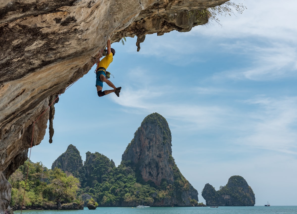
Mountaineering in India
Mountaineering is more than the pursuit of summits. It is a discipline that fosters resilience, self-reliance, and a deep appreciation for the mountain environment. In India, mountaineering carries cultural, scientific, and sporting significance. The Himalayas and other mountain ranges have shaped history, sustained communities, and inspired generations of explorers and adventurers.
Stretching across Jammu & Kashmir, Ladakh, Himachal Pradesh, Uttarakhand, Sikkim, Arunachal Pradesh, and the Eastern Karakoram, the Indian Himalayas offer diverse opportunities for mountaineering, from introductory climbs to technically demanding expeditions.
The Role of the Indian Mountaineering Foundation
Established in 1957, the Indian Mountaineering Foundation (IMF) is the apex body for mountaineering and allied adventure activities in India. Recognised by the Ministry of Youth Affairs and Sports, Government of India, the Foundation works to promote, regulate, and develop mountaineering, rock climbing, and trekking across the country.
The Foundation supports these activities through:
- • Facilitating Expeditions
- • Training and Capacity Building
- • Safety and Rescue
- • Conservation and Environmental Stewardship
Training and Opportunities
- • Structured training programmes and certification pathways.
- • Guidance on acclimatisation, weather, and altitude-related challenges.
- • A community of experienced mountaineers and instructors.
- • Opportunities to participate in national and international expeditions and climbing competitions.
Ethics and Responsibility
Mountains demand respect.
The IMF advocates responsible climbing practices that minimise environmental impact, uphold safety standards, and encourage respectful engagement with local communities.
Get Involved
Mountaineering begins with preparation. A trek, a basic mountaineering course, or participation in environmental initiatives can provide an introduction to the outdoors and mountain culture.
Explore the Indian Himalayas
The Himalaya, Karakoram and Hindu Kush ranges extend from Namcha Barwa in the east to the borders of Afghanistan in the west. Political maps show them as parts of India, Bhutan, Nepal, Pakistan and Afghanistan. A very large section of the Himalaya and an eastern section of the Karakoram, are in India. Broadly the Indian Himalaya consists of Arunachal, Sikkim, Uttarakhand, Himachal, Jammu & Kashmir and Eastern Karakoram. Though there are no 8000 m peaks in India except the Kangchenjunga, there are several peaks which are above 7000 m and a few of them are still unclimbed. A large number of peaks between 6000 to 7000 m are challenging and still virgin. Mountaineers in India have plenty of scope for exploration and conquest.
Also known as the Assam Himalaya, much about this area is not known. It stretches from Gori Chen in the east to Namcha Barwa. Due to government restrictions not many mountaineers have been there. There are several high peaks like Gyala Peri (7,150 m), Kangto (7,090 m) and Nyegi Kangsang (7,047 m), not many of which have been climbed from the Indian side. Some of them were approached from Tibet and climbed from the north. The only peak which has been regularly climbed from the Indian side is Gori Chen (6,858 m). Its lower peak, Peak II, has also had some infrequent visitors.
F.M. Bailey and H.T. Morshead were the first explorers here followed by F. Kingdon-Ward in 1939. H.W. Tilman also visited this area and wrote his report Assam Himalaya Unvisited. The book by F.M. Bailey No Passport to Tibet is an excellent reference. These slopes witnessed the full fury of the war in 1962. The Chinese troops came down the 'Bailey Trail' almost till the Sela Pass, which is why the area was closed to civilians for many years.
Sikkim shares a mountainous border with Nepal in the west and north and with China only in the north. All the early (pre-war) expeditions went through Sikkim to cross over to Tibet on their way to Everest. Francis Younghusband's famous expedition to Tibet also went through Sikkim.
Doug Freshfield was one of the first mountaineers to visit this area. His book Round Kangchenjunga is a classic record of all the peaks in Sikkim. In west Sikkim, peaks like Kabru (7,338 m) were climbed in 1935 by C.R. Cook. Others like Kokthang and Rathong were climbed much later. Even now, many have not been climbed from the Sikkim side, e.g.: Talung.
Northern Sikkim consists of the Zemu glacier valley from which rises the third-highest mountain in the world, Kangchenjunga. Paul Bauer and his German team repeatedly attempted to climb it via its western approaches before the Second World War. Ultimately the Indian Army team was successful in doing so, in 1977 and there have been several subsequent repeats. There are many peaks around Kangchenjunga, like Simvu and Siniolchu, which are tempting, open invitations to climbers.
Further north is Pyramid Peak, climbed by the Himalayan Association of Japan (HAJ) in 1993. In the vicinity are peaks like Jongsang and Chorten Nyima. Pauhunri with the pinnacle of Donkya Ri upon it, is one of the chief attractions on the eastern side. There is a lot climbers can do in the Sikkim Himalaya.
Kumaon
Kumaon consists of three different valleys. They lie to the west of Nepal. Kumaon is generally confused with Garhwal. In fact Garhwal was once a part of Kumaon until the British separated it and gave it a different name. The first valley, in the east, is the Darma Ganga valley. At its head are several peaks above 6,000 m, technically difficult to climb. Peaks like Sangthang and Lalla We can be approached from here.
The Central valley in Kumaon is the valley of the Milam Glacier. Beside its eastern branch is an excellent climbing area of the Kalabaland Glacier. The peak Chiring We (6,559 m) rises from the Kalabaland Glacier and was climbed only once in 1979 by the Indian team led by Harish Kapadia. To its south is Suitilla (6,373 m), a most formidable and difficult goal. At the head of the Milam Glacier are the exciting peaks Hardeol (7,151 m) and Tirsuli (7,074 m). Nanda Devi East has been climbed from this valley. Panch Chuli is the south-eastern valley of this section in Kumaon. It has five different peaks which were conquered with great difficulty, both from the East and the West.
The western valley of Kumaon is the Pindari valley, flanked by peaks like Panwali Dwar (6,663 m) and Nanda Khat. This area is very popular with climbers. The Sunderdhunga valley branches off from the Pindari and leads to the southern foot of the Nanda Devi Sanctuary.
Garhwal
Garhwal is a tract in the center of the Indian Himalaya. For many years mountaineers have visited and climbed in this area. North Garhwal consists of peaks like Kamet (7,756 m) and Mukut Parbat (7,242 m). Many high peaks here have not been climbed. The famous Hindu temple of Badrinath attracts many pilgrims.
Western Garhwal: The valleys to the extreme west of the Garhwal region house some very easy, gentle peaks. Many students and early mountaineers have trained in these areas. The Swargarohini group can prove a bit troublesome though. Bandarpuch West and Bandarpuch (6,316 m) have been climbed a couple of times. For a quick trip from Delhi this area is the most convenient.
Nanda Devi Sanctuary: The area from where the Rishi Ganga starts is the famous Nanda Devi Sanctuary, the centrepiece of the Garhwal region. Until 1934 the gorge of the Rishi Ganga was the least known part of the Himalaya. The Nanda Devi range is a long one, about 75 miles in circumference, about 6,000 m high, sheltering approximately 380 sq. km. of ice and snow. The Nanda Devi peak (7,816 m) is the most beautiful peak in the Indian Himalaya. It was climbed in 1936 by Tilman and Odell and the shoulders of both its peaks were traversed by Japanese mountaineers in 1976.
The other noteworthy peaks on the rim of the Sanctuary are Changabang (6,864 m), Rishi Pahar (6,992 m), and Bethartoli Himal (6,352 m). The Northern Sanctuary of Nanda Devi was visited by an expedition from Japan, who climbed several peaks as the first visitors to the area in 40 years. The northernmost peak of the inner Sanctuary, Changabang, was climbed in 1974 by the Indo-British team led by Chris Bonington. Four days later, Harish Kapadia's team climbed Devtoli (6,788 m), the inner sanctuary's southernmost tip. In spite of many successful conquests, there are still several unclimbed peaks here, particularly in the northern part of the sanctuary.
For preserving the fragile environment, this area is now closed to mountaineers. Only one army expedition was allowed to enter in the last 15 years. It is not known when and whether anyone will be permitted to climb here again.
Kullu: The lovely dales of Kullu have been a major attraction area for those who prefer to climb difficult but low peaks. The south Parvati area has peaks like Dibibokari, Pyramid, Papsura and Peak 20,101 (6,127 m). This area too, is open to all climbers with peaks like Mukarbeh and Indrasan (6,221 m), and has a lot to offer hobbyists and serious climbers alike.
Kinnaur: Kinnaur lies north of Shimla, in Himachal Pradesh. The National Highway leads through Kinnaur to Spiti. Recent changes in policy allow visitors entry to the area west of the road without official permission. High peaks like Jorkanden (6,473 m), Manirang (6,593 m) and several others are now easily accessible. Above the eastern valleys of Baspa, Tirung and Leo Pargial (6,791 m) rise many peaks above 6,000 m. Kinnaur's architecture, its people and customs could each attract curious minds and interested travellers.
Lahaul: The area north of the famous Rohtang Pass road consists of the valleys of Lahaul. It has been open to mountaineers for many years now. Around the Bara Shigri glacier rise peaks like Kullu Pumori (6,553 m) and Shigri Parbat (6,626 m). Towards its north the Chandra Bhaga group (CB Group) has peaks like Minar (6,172 m), Akela Kila (6,005 m) besides others with different numbers, of around the same height. Phabrang (6,172 m) and Mulkilla (6,517 m) are the chief draws of the west side. Motorable roads lead to almost all the valleys here and the approaches are easy and free of hassles.
Spiti: Spiti is the most barren Trans-Himalayan area. In the east, the highest peak is the defiant Gya (6,794 m), still unclimbed. The controversial Shilla (6,132 m) stands proudly above this valley. In the west are the Ratang, Gyundi and Khamengar valleys. Khangla Tarbo is one of the better-known peaks here. Here, too, no permits are needed.
Kishtwar: West of Lahaul along the Chandrabhaga river, which becomes the Chenab, is Kishtwar. Now due to the political troubles there, it is not easy to reach there and a thorough knowledge of prevalent conditions is a prerequisite. To climbers, it offers treats like Brammah I (6,416 m), Brammah II (6,425 m), Sickle Moon (6,574 m) and Hagshu (6,300 m). It is one of the most challenging and difficult areas if one's entry and exit is safe.
Ladakh: Ladakh is sometimes called 'Little Tibet'. It has a landscape and culture similar to that of Tibet. Caravans used to pass through Leh on the way to and from Central Asia. Almost all the valleys of Ladakh are now open to foreigners. The area of Pangong Lake has Kakstet peak (6,442 m) and the highest unnamed peak in the world (6,725 m). In south-east Ladakh, in the Rupshu valley there are peaks as high as 6,600 m around the beautiful lake of Tso Moriri. The highest amongst them is Lungser Kangri (6,666 m) neighbouring Chhamser Kangri (6,622 m).
Zanskar: Entire barren valleys of Zanskar, south of Ladakh were once inaccessible. But now a road runs through its centre. Hundreds of trekkers cross over to Padam in Central Zanskar. This is rapidly becoming one of the world's most popular trails. For serious climbers there are high peaks like Nun (7,135 m) and Kun (7,087 m). For others are peaks like Zanskar 1 (6,181 m) and Zanskar 2 (6,175 m). All these peaks arouse interest and excitement.
Kashmir: The valley of Kashmir was known for centuries for its beauty. Caravans passed through it. In recent times, trekkers and campers flocked to it. Early climbers attempted the small peaks in the south. For instance, Kolahoi (5,425 m) and Haramukh (5,143 m). A large area around Sonamarg was visited by British climbers. The Climber's Guide to Sonamarg, published by The Himalayan Club, is an excellent reference book.
The valleys in the extreme north of India are those of the Eastern Karakoram. These form a special group in the Great Karakoram Range. It has some very high mountains, many of them still unclimbed, and some climbed only in recent years.
Records reveal that this area was visited in 1821. Dr. T.G. Longstaff went there in 1901. From 1914 to 1922 several Italian and European expeditions climbed here. Col J.O.M. Roberts undertook explorations in 1946. After this, the area was closed for many years. In the 1970s different Japanese teams crossed over from Bilafond la onto the Siachen glacier and climbed peaks like Teram Kangri I (7,462 m) amongst others. The Japanese mountaineers were very active here, and climbed many difficult peaks. Then, once more, the area was closed to all for many years.
In 1984 members of a Japanese expedition became the first foreign mountaineers to be allowed into this area from the Indian side. They climbed Mamostong Kangri I. The following year an Indo-British team climbed Rimo III and a few other peaks in the Terong Valley. Some peaks on the Siachen glacier were climbed by the Indian Army. There are still several enigmatic peaks in the Siachen Muztagh like Saltoro Kangri I and II.
The second group of mountains in the Eastern Karakoram is that of the Saser Kangri. This particular peak was approached by Col. Roberts and finally climbed from the eastern side by an Indian team. A Japanese team made the first ascent of Saser Kangri II West (7,518 m). The eastern peak of Saser Kangri II remains one of the highest virgin mountains in the area.
The third group is that of Rimo Muztagh. The famous Central Asian trade route over the Karakoram Pass goes this way. Chong Kundan I (7,071 m) was climbed in 1991 by an Indo-British team. Chong Kundan II (7,004 m) is still unclimbed. The valleys of Eastern Karakoram are open to joint ventures between Indian and foreign mountaineers. Permits for climbing are readily available for almost any peak here.
Indian Expeditions
This section provides comprehensive information and guidelines for the planning and conduct of mountaineering expeditions in India. It includes details on the assistance available from the Indian Mountaineering Foundation (IMF), as well as the procedures for submitting the Expedition Application and Expedition Report, both of which are to be completed online.
As an expedition organiser, you are strongly advised to familiarise yourself with all applicable guidelines, requirements, and conditions governing the issue of an expedition permit by the IMF.
It is the responsibility of the expedition organiser to ensure that all necessary procedures are followed and that the expedition remains fully compliant with the terms and conditions of the IMF permit throughout its planning and conduct.
IMF Conservation Pledge
“Leave no waste, equipment, or unnecessary material behind. Leave the mountain cleaner than you found it.”
Section 1: Environment Guidelines for Mountaineering Expeditions
Preserving the Indian HimalayaThe Indian Mountaineering Foundation (IMF) has established these guidelines to help protect and maintain the Indian Himalaya. Every expedition must ensure that no garbage, waste, or mountaineering equipment is left behind at the Base Camp, on the trails, or on the mountain.
Proper waste management and retrieval of equipment are the responsibility of every expedition member and support staff. These practices are essential for protecting the fragile Himalayan environment for future generations.
1. General Guidelines for Garbage Management
- • All expedition members and support staff must be properly briefed and trained to identify biodegradable and non-biodegradable waste.
- • Everyone must understand the correct method of disposal for each type of waste.
- • Above the snow line, natural decomposition is extremely slow. Waste left on the mountain can remain there and cause pollution for many years.
- • Every expedition should make a conscious effort to leave campsites, trails, and climbing routes cleaner than they were found.
2. Disposal of Biodegradable Waste
Definition: Biodegradable waste is waste that can be broken down into basic compounds by microorganisms, air, moisture, or soil within a reasonable period.
Examples include: Food and kitchen waste, Green waste, Paper, Biodegradable plastics, Human waste etc.
Disposal Rules:
- • Biodegradable waste must be disposed of only below the snow line.
- • At the Base Camp, a deep toilet pit must be dug in the soil.
- • All human waste produced during the expedition must be deposited in this pit.
- • Biodegradable kitchen waste must be placed in a deep pit at Base Camp.
- • The kitchen-waste pit must be properly covered at the end of the expedition.
3. Disposal of Non-Biodegradable Waste
Definition: Non-biodegradable waste cannot be naturally broken down by microorganisms, air, moisture, or soil. It can remain in the environment indefinitely.
Examples include: Plastic, Rubber, Styrofoam, Glass, Metal, Other materials that do not naturally decompose.
Disposal Rules:
- • All non-biodegradable waste must be collected and packed in sacks.
- • Carried down from the mountain camps to the road head.
- • Disposed of at or below the road head.
- • Submitted to vendors, local garbage collectors, or other authorised disposal facilities, or disposed of as directed by the local authorities.
- ⚠️ Under no circumstances should non-biodegradable waste be abandoned on the mountain.
Section 2: Mountaineering Equipment Management
Retrieval & Camp Stores AccountabilityExpeditions must ensure that all mountaineering equipment is brought back after use. The following rules must be followed:
All ropes and technical climbing equipment must be retrieved and carried back.
Equipment may be left behind only when retrieving it could compromise the safety of the expedition or its members.
If any technical equipment is left behind for safety reasons, the expedition report must clearly state the reasons for non-retrieval.
Tents, bivouac materials, and other permanent camp stores must not be abandoned on the mountain. All temporary and permanent camp materials must be properly collected and brought back.
Section 3: Expedition Safety Advisory
Risk Mitigation, Medical Coverage & Preparedness| Subject | Advisory Details |
|---|---|
| Planning | The choice of climbing objective should be based on the expertise, experience, technical skills, and fitness of the expedition team. Objectives should be realistic and appropriate to the team's capabilities. |
| Insurance | Ensure that the expedition insurance provides adequate coverage for altitude- and exposure-related medical conditions, including frostbite, hypothermia, High-Altitude Pulmonary Edema (HAPE), and High-Altitude Cerebral Edema (HACE). Such conditions should preferably be included in the main insurance policy or covered through a separate medical/Mediclaim policy. |
| Gear Check | Use high-quality and reliable mountaineering equipment, particularly critical safety equipment. Ropes should be carefully checked for condition, damage, wear, aging, and deterioration through appropriate inspection and handling. Also inspect runners and slings, carabiners, harnesses, and helmets. It is strongly recommended that safety helmets and reliable inter-camp communication equipment are carried and used by all team members. |
| Medical Preparedness | The Expedition Leader should obtain a medical fitness certificate from every team member confirming their fitness to undertake the expedition. Wherever possible, the team should include a qualified doctor or trained paramedic. |
| Medical Training | Expedition Leaders and team members are advised to participate in the Emergency Responder First Aid for Wilderness training programme. Click here (View Calendar) → |
| Weather | Conduct a mountain weather assessment before commencing the climb. |
Section 4: Instructions for Expedition Leaders
Qualifications, Team Rules & ReportingThe following requirements and important information should be carefully noted by all Expedition Leaders and organisers before planning and conducting an expedition.
1. Qualifications of the Expedition Leader
The Expedition Leader must meet each of the following criteria:
- •Must be an affiliate member
- •Must be above 25 years of age.
- •Must have successfully completed an Advanced Mountaineering Course (AMC) from a recognised institute.
- •Must have participated in at least two expeditions to peaks above 6,400 metres.
- •Must have successfully summited at least one peak above 6,400 metres.
2. Qualifications and Composition of the Team
- •All team members must be members of the IMF with valid Affiliate IDs.
- •All relevant experience and course certificates of the members must be updated in their respective online profiles.
- •The team, including the Expedition Leader, should have at least 50% of its members qualified in an Advanced Mountaineering Course (AMC) and possess relevant expedition experience.
- •Of the remaining members: Up to two members may be included based on their experience in high-altitude trekking, rock climbing, or related activities; other members may be qualified in a Basic Mountaineering Course (BMC).
- •The final team composition should be based on the team's ability to respond effectively to emergencies and manage all reasonably foreseeable contingencies on the mountain.
3. Total Number of Team Members in an Expedition
Expeditions are not permitted to include trekking parties, film crews, or other persons as additional members beyond the permitted climbing team.
4. Hiring Equipment from IMF
Mountaineering equipment is available for hire from the IMF Mart, subject to availability and payment of the applicable security deposit and hiring charges.
5. Boarding and Lodging at IMF
A 30-person dormitory is available at the IMF for expedition teams. Accommodation is provided on a first-come, first-served basis, subject to availability.
6. Booking of Peaks
- •Peak bookings are made on a first-come, first-served basis.
- •Expedition organisers should submit their applications and all required documents well in advance.
- •Any delay in submitting the application or supporting documents may result in the cancellation of the provisional peak booking.
- •Primary and Secondary choice of peaks may be booked online on the IMF Portal.
7. Duration of the Expedition and Permit
- •Peak bookings are generally valid for 30 to 45 days, calculated from Base Camp to Base Camp. The climbing permit will normally be issued for the same duration.
- •A maximum of 30–35 climbing members may be permitted during the applicable period.
- •Where a mountain attracts more climbers than the permitted number, climbing permits may be scheduled with a 10-day gap between teams.
- •Expedition members should be properly briefed and prepared to share the mountain and coordinate their climbing activities with other authorised expeditions.
8. Expedition Report and Climb Certificate
The IMF will issue the Climb Certificate only after receiving the completed Expedition Report. Before issuing the certificate, the IMF may review the report through its Expedition Report Verification Committee. If any irregularity, misrepresentation, or non-compliance is identified in the report, the IMF may take appropriate regulatory action against the expedition.
9. Violations, Penalties and Accountability
Any member of an expedition, including personnel of a tour or expedition operator where the expedition is organised through an agency, who is found climbing or attempting to climb a peak without an IMF permit, or who violates applicable environment-protection rules, may be debarred from undertaking mountaineering expeditions in India for a period of 2 to 5 years.
In addition, such violations may attract action under applicable laws and regulations. In the event of an accident caused by negligence on the mountain, the Expedition Leader may be held accountable and may be debarred from participating in mountaineering expeditions for a period of 2 to 5 years.
Expedition Leaders and members are therefore expected to strictly comply with all IMF requirements, permit conditions, safety procedures, and environmental guidelines.
Section 5: Expedition Reporting Guidelines
Mandatory Online Verification & Climb Certificate IssuanceThe Expedition Leader is required to submit the Expedition Report to the Indian Mountaineering Foundation (IMF) within two months of the first summit attempt.
The report must be submitted online and should include all relevant information and supporting materials, including:
- •Details of the expedition and team members
- •Summit attempts and outcomes
- •Route and climbing details
- •Photographs and videos documenting the expedition
- •Details of significant incidents, accidents, or deviations
- •Compliance with environmental & equipment-retrieval rules
Photo Evidence: Photo evidence pertaining to garbage disposal and equipment retrieval must be included in the expedition report. Teams observing non-compliance with IMF guidelines by earlier expeditions are requested to present photographic evidence to the IMF.
Random Checks: IMF representatives are being deployed to conduct random checks on expeditions on the mountains and collect evidence of any violations of IMF guidelines.
The Expedition Leader should ensure that the report is complete, accurate, and submitted within the prescribed timeframe. IMF will review the submitted Expedition Report and supporting materials before issuing the “Climb Certificate”.
Indian expeditions till date
expeditions
| Year | Name of the expedition | Leader | Peak with height | Period |
|---|---|---|---|---|
| No expeditions match. | ||||
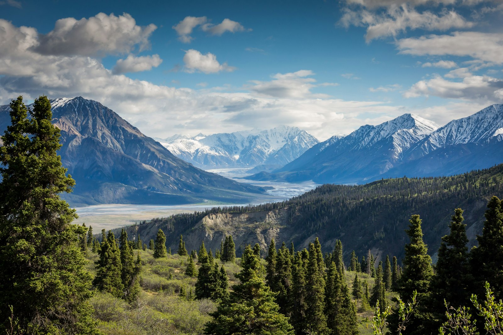
Foreign Expeditions
International mountaineering teams and foreign climbers wishing to climb peaks in the Indian Himalayas must apply through the Indian Mountaineering Foundation. The IMF coordinates required security clearances, peak bookings, and assigns an authorized Liaison Officer for every foreign expedition.
Guidelines for Expedition Application and Peak Booking
Online Process, Clearances & ApprovalsCreate an Online Profile
Create an online profile for each team member and provide all required personal details, qualifications, and supporting documents.
Submit Application
Complete and submit the online application form for the proposed expedition, along with all required documents and information.
Obtain IMF Approval
The expedition application must be reviewed and approved by the Indian Mountaineering Foundation (IMF) before proceeding with peak booking.
Pay Applicable Charges
Once the expedition application is approved, the team must pay the applicable handling charges and peak booking fee at the time of booking.
Guidelines for Expedition Permission:
Open Area Peaks
After completion of the required due diligence and verification, the IMF generally issues the expedition permit within one week.
Inner Line & Restricted Area Peaks
Expeditions to Restricted Area or Inner Line peaks require additional security clearances. The proposal (peak name, route map, day-to-day itinerary, biographical details) is submitted by IMF to the Ministry of Home Affairs (MHA) and Ministry of Defence (MoD).
The clearance process generally takes 1 to 2 months. Status is updated live on the IMF online portal.
Visit to the IMF Office
Upon arrival in New Delhi, the team must visit the IMF office for a pre-scheduled meeting. The Director briefs the team on requirements and formally assigns a Liaison Officer (LO).
Expedition Report
The Expedition Leader must submit the Expedition Report online within the prescribed timeframe, including photographs, videos, documents, and supporting information.
Feedback Form
The Expedition Leader must complete and submit the online feedback form at the end of the expedition.
Roles and Responsibilities of the Liaison Officer
Authorised Representative, Emergency Support & ProtocolA Liaison Officer (LO) must accompany every foreign expedition, irrespective of whether the proposed peak is located in a Restricted Area or an Open Area.
The Expedition Leader may choose to pay US$ 500 to the IMF in lieu of providing mountaineering equipment for the Liaison Officer (LO). Upon receipt of the payment, the IMF will arrange the requisite equipment for the LO. The amount may be paid along with the applicable peak handling charges.
The expedition team must bear the cost of the Liaison Officer’s travel, board and lodging from New Delhi to the mountain area and back. The team must also provide for one cook-cum-porter from the road head for the duration of the expedition.
The expedition team must inform the IMF of its exact date of arrival in New Delhi and mode of travel at least two weeks in advance. The team must not commence the expedition or proceed towards the mountain without the assigned Liaison Officer. The expedition may begin only after the LO has joined the team.
In the event that assistance is required from the Army, Police, or Para-Military Forces, the LO will coordinate with the concerned DM/DC/SDO/SDM. The LO will also facilitate and coordinate arrangements for helicopter or ground-based search and rescue operations, as required.
In the unfortunate event of the death of any expedition member or porter, the LO must coordinate with the concerned District Commissioner (DC) and obtain the official death certificate before the expedition team leaves the mountain area.
Foreign expeditions till date
expeditions
| Year | Expedition | Leader | Peak with height | Period |
|---|---|---|---|---|
| No expeditions match. | ||||